
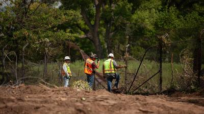

Contractors with Fisher Sand & Gravel examine an old border barrier in the small ranching community in Lochiel, where the Trump administration plans to build a new double wall. (Angela Gervasi/AZPM)
This article was originally published by AZPM.
A new online mapping tool aims to document wall construction and other federal projects along the nearly 2,000-mile U.S.-Mexico border — using help from the people who live there.
The Border Chronicle, a Tucson-based independent news outlet, launched the initiative — called “Wall Watch” — last week. It arrives as the Trump administration continues to ramp up border barrier construction, ranging from a floating buoy wall in Eagle Pass, Texas, to a double bollard fence that would cut through the Tohono O’odham Nation.
“We thought of this idea, Wall Watch, as a way for communities up and down the border to have more of a real-time look at what is actually happening,” said Border Chronicle co-founder Melissa del Bosque.
How it works
While browsing through the interactive Wall Watch map, users can explore the various layers of border infrastructure that already exist, like surveillance towers, land ports of entry, and vehicle barriers.
But the map also depends on crowdsourced reports from border-area residents who observe new construction. Following the website’s directions — written in English and Spanish — users can submit up to five images, along with other basic details, like GPS coordinates and the date of the observation.
The submissions go to an administrator, Tucson-based geographer Dugan Meyer, who verifies the reports.
“Then if it's good to go, he'll post it on the Wall Watch map,” del Bosque explained.
The federal government already documents border barrier construction on its interactive Smart Wall Map. There, users can browse through a wide assortment of ongoing projects, ranging from a double wall that would stretch through the San Rafael Valley to new technology for the existing barrier south of San Diego.
But del Bosque says the government’s tool doesn’t give the full picture.
“You can see where the awarded contracts are and contracts in process, but it lacks in detail … It's not entirely clear by looking at (the Smart Wall) map as to what exactly is happening,” del Bosque said.
Wall Watch, she added, is aiming for a more “continuous, real-time picture” of the border.
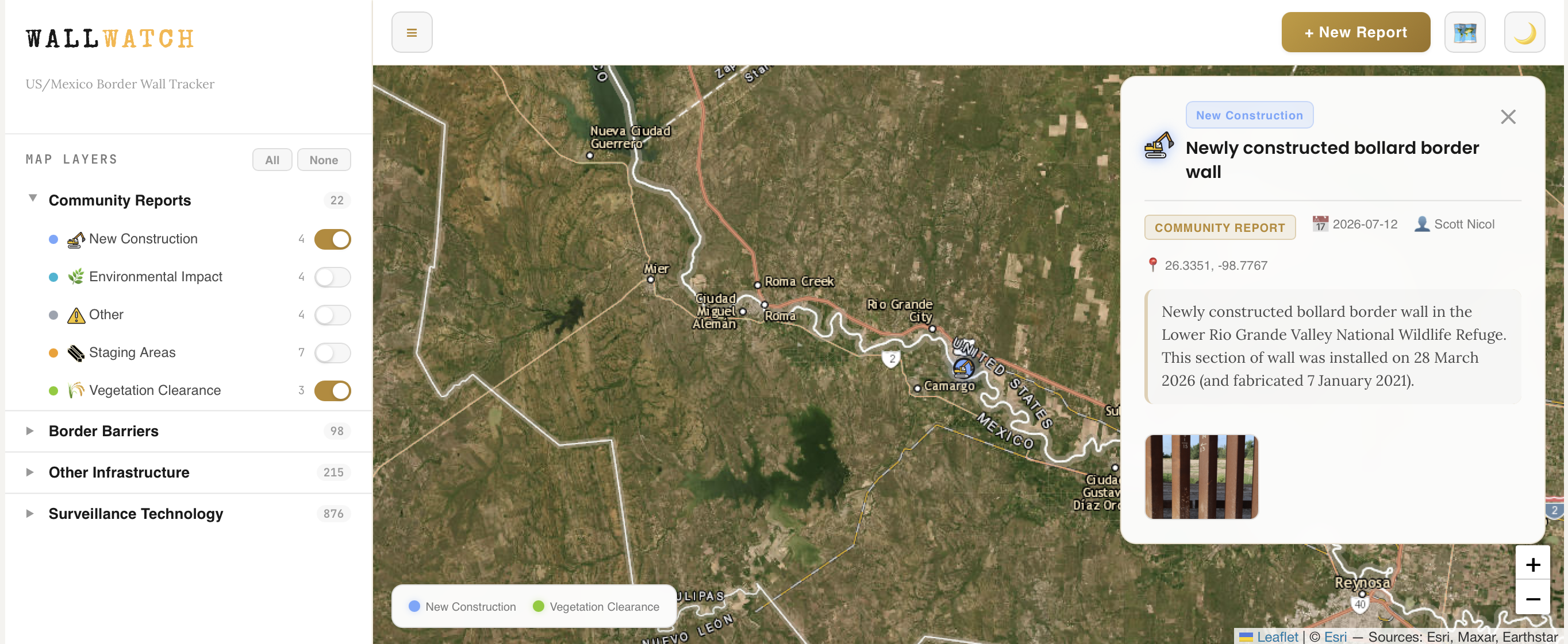 A community report on Wall Watch's interactive map. (The Border Chronicle)
‘A lot of anxiety, a lot of concern’
In recent months, del Bosque said, Border Chronicle staff began getting calls from border-area residents — from Texans to Californians — seeking answers about new construction projects in their own neighborhoods.
“What residents were telling us is that they were getting no information from the federal government about what their plans were … So there was a lot of anxiety, a lot of concern,” she said.
Del Bosque said she began reporting on border walls in 2008 — but back then, there was “more of a process” in terms of how the federal government communicated with local residents about border-related construction projects.
“So, there would be these community meetings. There were community liaisons. There was an opportunity for residents to be able to voice their concerns and the impacts,” she said.
Del Bosque is not alone in wanting better communication.
This spring, a coalition of 14 judges in Texas’ border counties penned a letter to the Department of Homeland Security, asking the agency to coordinate with landowners and local officials before finalizing infrastructure projects.
On Aug. 7, Republican Texas Sen. John Cornyn made a similar request in a letter to DHS about the agency’s controversial plans to install new border technology and infrastructure in Big Bend National Park.
"In the past, such communications between DHS and state and local leaders have occurred,” he wrote.
Cornyn continued: “But it appears the level of coordination and communication related to proposed construction in the Big Bend region has not been as fulsome as in prior years."
Reached for comment, a Customs and Border Protection spokesperson told AZPM the federal agency regularly “engages with stakeholders,” including residents and landowners and local government officials. CBP did not respond to specific questions about how often federal officials hold meetings with local residents in the event of border-barrier construction.
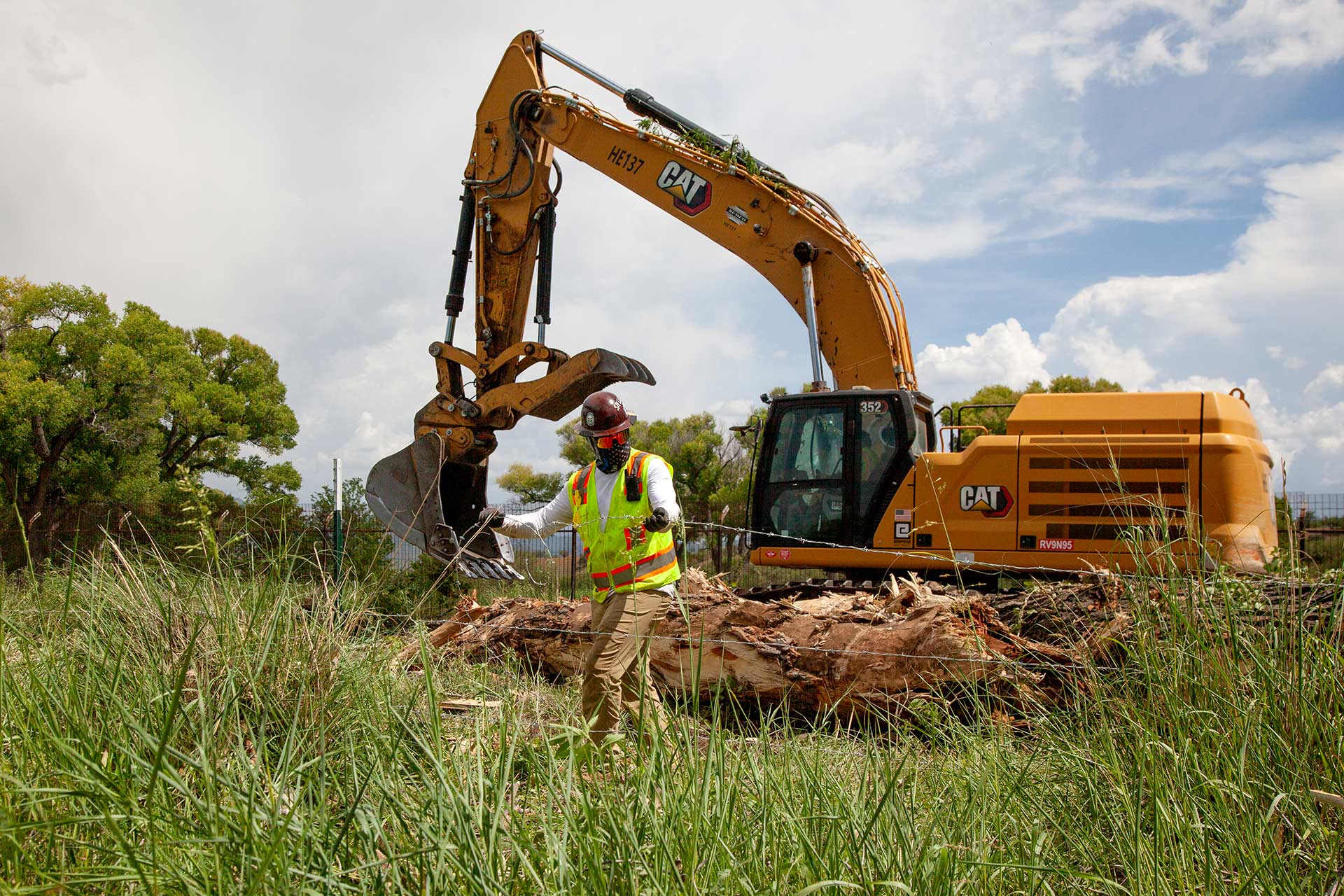 A contractor with Fisher Sand & Gravel works along the border in southeastern Santa Cruz County on July 29, 2026. (Angela Gervasi/AZPM)
Buoy walls and bollard fences
So far, Wall Watch has garnered 22 community-sourced reports of new construction across the border — mostly in Texas. In a corner of Zapata County about 30 miles south of Laredo, for example, a report from a resident describes newly observed bollard wall construction just east of the Rio Bravo. Farther north, in Eagle Pass, another submission features a slightly grainy cellphone photo. In the distance, a yellow excavator digs into a river.
“Barge with heavy equipment preparing for river buoy installation,” the report notes.
Eagle Pass, del Bosque pointed out, has presented something of a test case for the Trump administration in its efforts to bolster border infrastructure. Earlier this year, contractors installed miles of floating buoys along the Rio Grande to create a floating border barrier. But in June, possibly hundreds of buoys broke free from the barrier — prompting the shutdown of two international bridges in the Texan border town.
“Once you see (the Wall Watch map) from a region-wide perspective, you see just how massively the landscape is being transformed under the name of national security, or border security,” del Bosque said.
So far, the map only features two submissions along Arizona’s border — photographs of a large construction staging area on the southwestern edge of Cochise County.
But the project’s creators hope for more community engagement as time passes.
“So much of the border narrative is dictated by people who don't live at the border,” del Bosque said.
She added: “This is an opportunity for border residents to build that reality on the ground and to show the rest of the country, ‘Look, this is what's happening in my backyard.’”






(0) comments
Welcome to the discussion.
Log In
Keep it Clean. Please avoid obscene, vulgar, lewd, racist or sexually-oriented language.
PLEASE TURN OFF YOUR CAPS LOCK.
Don't Threaten. Threats of harming another person will not be tolerated.
Be Truthful. Don't knowingly lie about anyone or anything.
Be Nice. No racism, sexism or any sort of -ism that is degrading to another person.
Be Proactive. Use the 'Report' link on each comment to let us know of abusive posts.
Share with Us. We'd love to hear eyewitness accounts, the history behind an article.